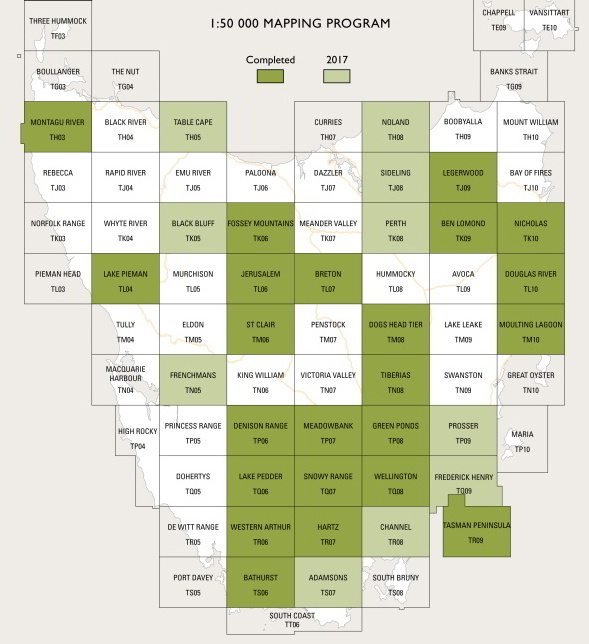
TASMAP Topographic Map Range
The Tasmanian Government (TASMAP) is progressively introducing a 1:50 000 mapping range of the state. Initially maps will be produced in areas where 1:25 000 map stocks run out and are in demand. They will incorporate the best features of the 1:25
000 and 1:100 000 mapping series providing clear topographic detail, with improved symbols and content for a better representation of buildings, hill shading and a simplified
classification of vegetation.
The 1:50 000 Series covers the entire State with 80 maps (see key for roll-out progress). Each map covers a 30 x 40 kilometre area with a 1
kilometre grid based on the Map Grid of Australia (MGA94) which utilises
the Geocentric Datum of Australia 1994 (GDA94). At this scale, 2cm on the map represents 1km on the ground.